Welcome to AeroSite3D

Your partner in advanced aerial mapping

Discover Our Services

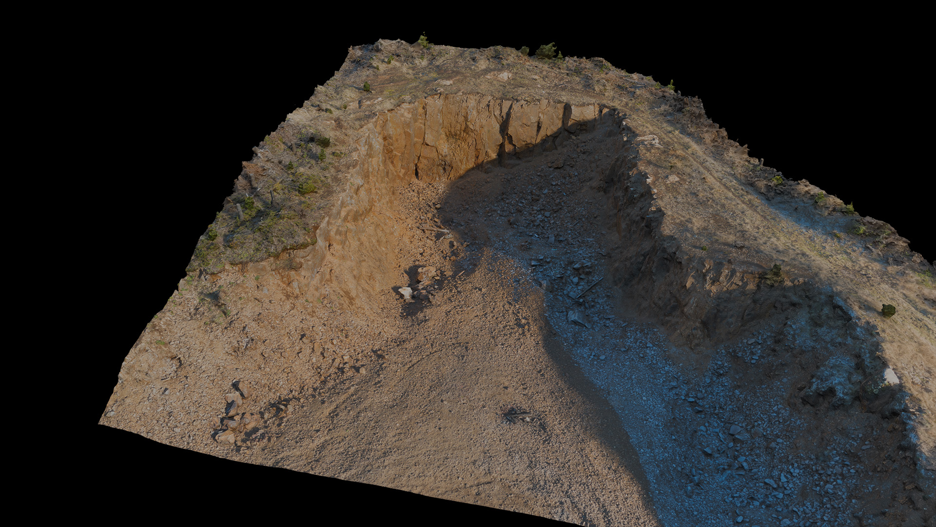
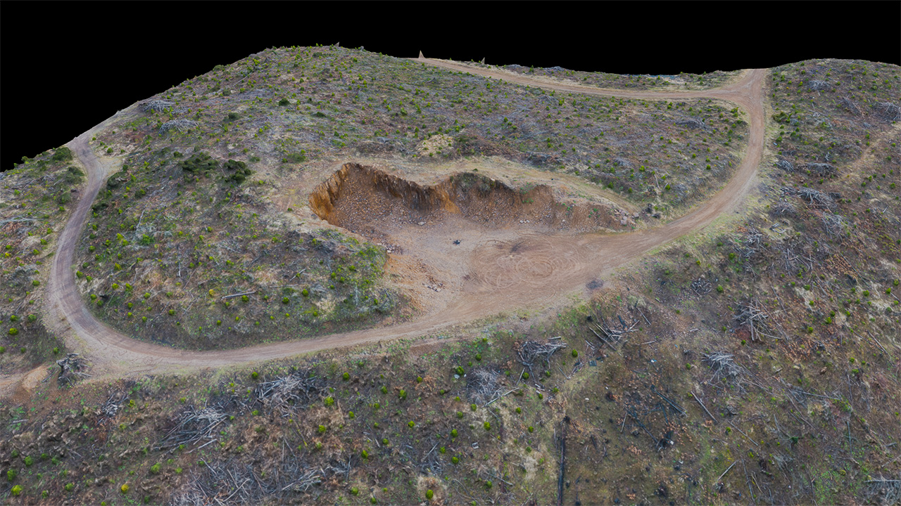
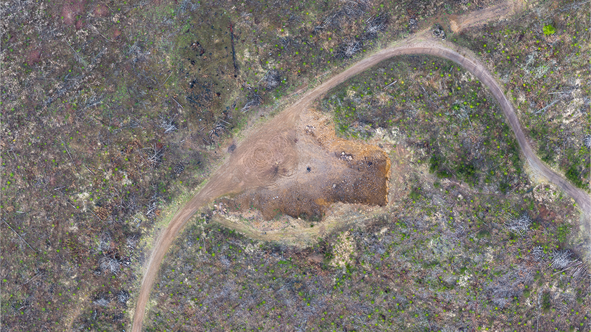
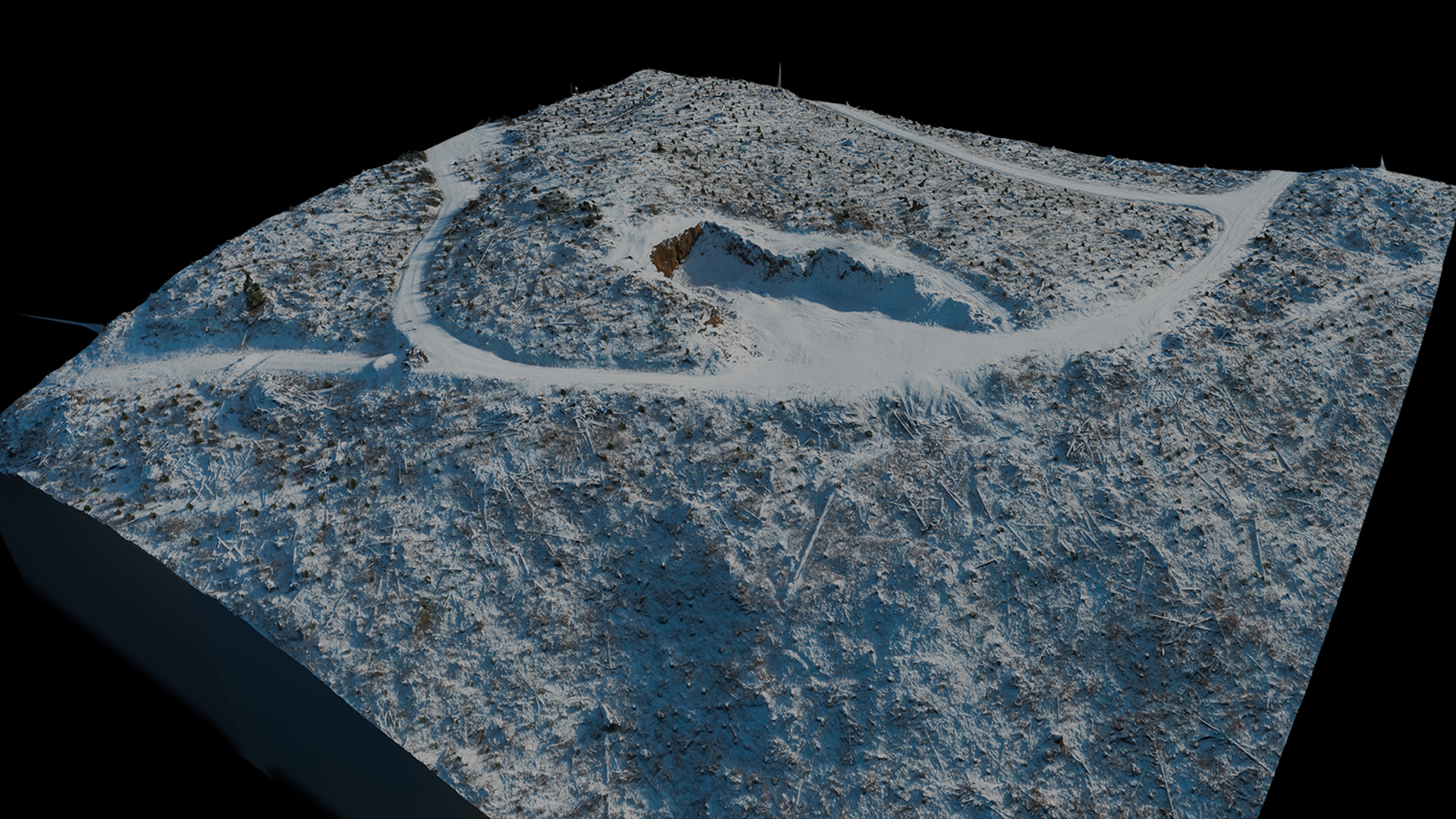
Advanced Aerial Mapping

Introducing AeroSite3D, harnessing the power of aerial data to enhance your construction projects. Experience detailed 3D models that let you view your site from any angle, and orthographic maps that allow you to visualize your site from above. Easily track site progress, ensuring that your project stays on track. Whether you're managing a small-scale project or an expansive site, our innovative solutions deliver the insights you need to build with confidence.

3D Aerial Model Example

Our Services

3D Model

3D Models

Our highly detailed 3D models allow you to instantly view your site from any angle and examine terrain. Perfect for advanced project planning.

2D Ortho Map

2D Orthographic Maps

View your site from above with our 2D orthographic maps. Zoom in and examine the details of your project, with detail as high as 700 pixels per square foot. Quickly make measurements with the GIS software of your choice.

Remote Project Updates

Remote Project Updates

View your project's progress remotely. Examine the intricate details of your site without the need to waste time traveling in-person.

Explore All Services

Looking for Pricing?

Get an instant estimate for your next project. Click below to access our full pricing page.

View Pricing

How It Works

1

Initial Consultation

We begin by discussing your site details, timeline, and project goals. We’ll confirm whether you need 3D models, orthomosaics, topographic data, or elevation contours. If georeferencing is required, a licensed surveyor or your in-house survey team will need to provide control points before we fly. These ground control points ensure that all mapped data precisely aligns with your chosen coordinate system.

2

Data Capture

Our licensed drone pilots plan and conduct multiple flight paths over your site, capturing high-resolution imagery from various angles. During this phase, we monitor weather patterns, airspace restrictions, and any safety considerations to ensure a smooth, compliant operation.

3

Processing

Using advanced photogrammetry software, we stitch together aerial images into 3D models and orthomosaics. If you provided control points, those are integrated into the model to match your desired coordinate system with sub-inch accuracy.

4

Delivery

Finally, we deliver all relevant outputs—3D models, orthomosaics, elevation contours, and more—in your preferred formats (GIS layers, CAD files, PDFs, etc). Our team remains on standby to answer questions, provide additional data visualizations, or schedule periodic drone flights to track progress throughout your project’s lifecycle.

Explore Our 3D Model

Rotate, zoom, and inspect our aerial 3D model in real time.

(2 acres, Normal Detail)

Ready to Get Started?

Talk to us today about your project goals and discover how our aerial mapping solutions can bring them to life.

Contact Us

See Your Project in a Whole New Dimension

Transform your perspective with 3D Models and Orthographic Maps from AeroSite3D.